Knitsley Fell Trig Point
Trig Point In Witton le Wear, County Durham
The Knitsley Fell trig point sits on Knitsley Fell (284m) near Wolsingham.
Height - 284m// Bracket - S4251 // Postcode - DL13 3PA
Login to be able to bag trig point and see which trig points are left on your to do list.
Login To Bag Trig Points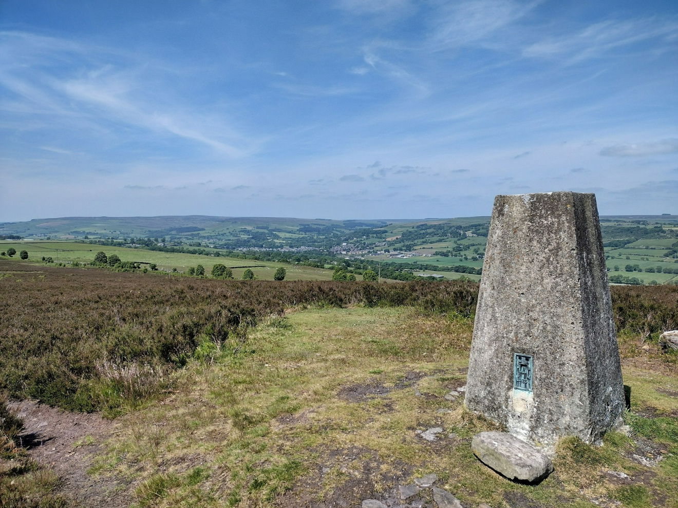
This is the Knitsley Fell trig point (284m) near Wolsingham.
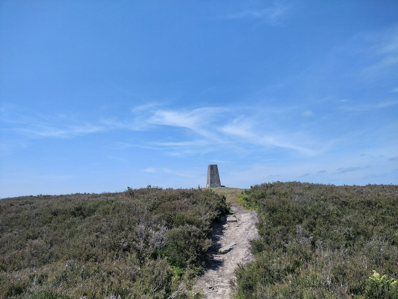
Once parked on the Howlea Lane roadside, head NW up the road for a short distance before turning right on the permissive path. Follow the path until the trig comes into view on the right.

The views from the trig over the River Wear and Wolsingham are beautiful.
This route is only 0.6km.
Follow the above route or find it on OS Maps.
Login to be able to bag trigs and see which trigs are left on your to do list.
Login To Bag Trig PointsHow To Find Knitsley Fell Trig Point
Where Is Knitsley Fell Trig Point?
Lat / Long
54.710395, -1.855358
What three words
Where To Park For Knitsley Fell Trig Point?
Lat / Long
54.709101, -1.86101
What three words
There is room for a couple of cars on the side of Howlea Lane. There is further parking at ///trouser.worlds.blog.
More Trig Points Near Witton le Wear
Find more trig points near to Witton le Wear, County Durham.
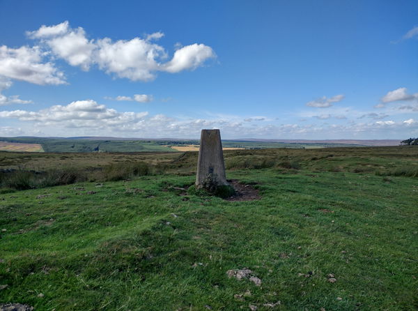
Woodland Trig Point
370m Bracket S4310 Witton le WearThe Woodland trig point sits on Hindon Hill (370m) near Witton le Wear.
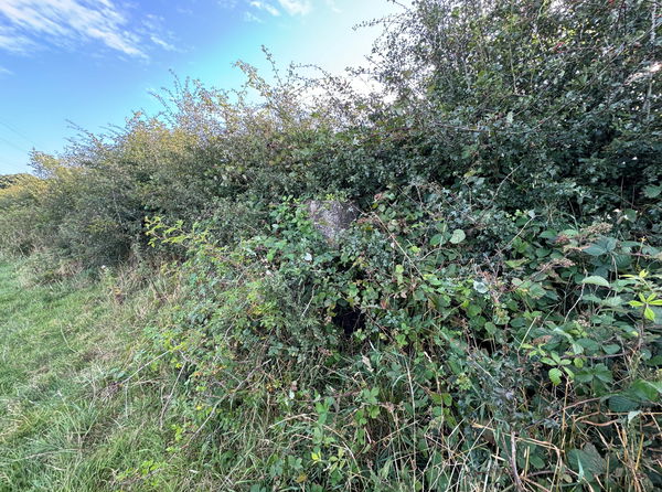
Etherley Lane Trig Point
167m Bracket S4178 Witton le WearThe Etherley Lane trig point sits in a hedge (167m) near Witton Le Wear.

Find Us On Facebook
Come and join our friendly Facebook group and share photos of your trig bagging.
Or ask any questions about the trig points in Durham.
Join Durham Trigs Facebook Group